Hokianga nui a Kupe
Hauora Hokianga provides a comprehensive range of integrated health services to a population that resides within an area specifically defined by the geographic boundaries of the old Hokianga County Council. These boundaries are traditionally described in Māori society via proverbs (whakatauki) that link the mountains (nga maunga) that surround the Hokianga River;
Puhanga tohora titiro ki Whakatere
Whakatere titiro ki Te Ramaroa
Te Ramaroa titiro ki Whiria, te paiaka o te riri, ko te kawa o Rahiri
Whiria titiro ki Panguru, ki Papata
Panguru, Papata titiro ki Maungataniwha
Maungataniwha titiro ki Whakarongorua
Whakarongorua titiro ki Puhanga tohora
The Hokianga River is a long estuarine drowned valley on the west coast of the North Island of New Zealand. Hokianga is in the Far North District, which is in the Northland Region. It is situated 85 kilometres northwest of Whangarei and 25 kilometres west of Kaikohe. It covers an area of 1,520 sq. kilometres. The river estuary extends inland for 40 kilometres from the Tasman Sea. It is navigable for small craft for much of its length, although there is a sand bar across the river mouth.
In today’s fast-paced world, most of us are always on the lookout for ways to de-stress and unwind. Whether it’s through a relaxing getaway or a day spent indulging in our favorite hobbies, we all need some time to rejuvenate and take care of ourselves. That’s where healthcare and wellbeing education come in. By learning about the many ways in which we can prioritize our health and wellbeing, we can lead happier and more fulfilling lives. It’s no secret that gambling can be a fun and exciting way to let loose and enjoy ourselves, which is why NZ Casino Online can be such a great way to combine entertainment with financial responsibility.
Whether you’re a seasoned gambler or looking to try your luck for the first time, a low wagering casino bonus in NZ can help you maximize your winnings without breaking the bank. This can free up extra funds that you can use to invest in your own wellbeing, such as paying for a gym membership or signing up for a meditation class.
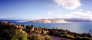
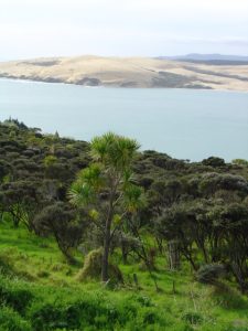
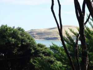
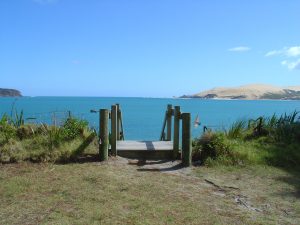
It is a place of natural beauty and has a calm and peaceful spirit. The kauri forests of Waipoua, Waima, Omahuta, Puketi, Mangamuka and Warawara surround the Hokianga River. Niwa (north head) and Arai Te Uru (south head) are represented in Māori oratory as taniwha; guardians of the river mouth.

Hokianga is considered to be the oldest Māori settlement in Aotearoa – New Zealand, and is a heartland for the people. The original Hokianga name, Te Puna o Te Ao Marama (“The Spring of the World of Light”) is still used today, as is the latter, Te Kohanga o Te Tai Tokerau (“The Cradle of the Northern People”). Hokianga is rich in history and according to tradition, the great pacific navigator and explorer, Kupe settled here over 1,000 years ago after his journey of discovery from Hawaiiki. Kupe then navigated the length of Te Ika nui a Maui (North Island) naming many places on his way. Kupe stayed and then returned to his ancestral home from Te Puna o Te Ao Marama that later became known as Te Hokianga nui a Kupe hence the name Hokianga, cemented in history from that time to the present day. Later generations followed Kupe’s path and settled the Hokianga region and beyond.
In the 14th century, the great chief Puhi landed just south of the Bay of Islands. The tribe of Puhi, Ngapuhi, slowly extended westwards to reach the west coast and colonise both sides of Hokianga. Rahiri, the 17th century founder of the Ngapuhi iwi, was born at Whiria Pa to the south of the harbour, where a monument stands to his memory.
In this process of expansion Ngapuhi created and maintained over centuries a complex network of walking tracks, many of which evolved into today’s roads. Wesleyan (Methodist) and later Anglican missionaries were guided along these ancient routes to make their own discovery of Hokianga and its abundant and accessible timber resources. Their reports soon reached merchant captains in the Bay of Islands.
History – Post European
From 1822, Hokianga became a place of early European settlement in New Zealand. Within six days of the 1840 Waitangi signing, Governor Hobson, keen to secure Ngapuhi support, trekked across to the Mangungu Mission Station near Horeke where 3,000 were waiting. This was the second signing of Te Tiriti o Waitangi. With these signatories, Hobson went on to claim support from the biggest tribe in the country.
Embark on a thrilling gaming adventure with Action Casino Canada, your premier destination for top-tier online casino play. At Action.cad.casino, excitement awaits as players dive into a vast ocean of slot machines, table games, and video poker, all designed to cater to an array of preferences and playing styles. Action Casino is renowned for its dynamic gaming atmosphere and robust platform, ensuring a seamless and engaging user experience. Complemented by a suite of generous welcome bonuses and loyalty incentives, the casino keeps the action alive, rewarding players as they enjoy their favorite games. What’s more, with unwavering dedication to customer support and the assurance of stringent security measures, Canadian players can rely on a safe and fair gaming environment. Whether you’re a casual player or a casino aficionado, Action Casino Canada is where the thrills are real and every play is packed with potential.
With the fate of the nation being signed into history, the axe men of Hokianga scarcely missed a beat. At any one time, as many as 20 ships could be loading Hokianga timber. Whole hillsides, suddenly bared of vegetation, began to slip into the harbour, choking its tributaries with mud.
Although relationships between Māori and Pākehā were frequently tense (never more so than the Dog Tax War of the 1898), a spirit of cooperation and partnership has prevailed through to current times.
Through the late nineteenth and early twentieth centuries the main commercial activity of Hokianga centered on forestry. The kauri industry contributed much to the economic growth of early New Zealand and supplied timber for building construction in Sydney, San Francisco, Auckland and Wellington.
When the forest resources finally declined in the 1920s, the dairy industry emerged with small-scale farming scattered throughout the whole of the Hokianga area. The small dairy-farming unit well suited the lifestyle and the predominant tribal land tenure of the area. The harbour provided a means of transport for the cream cans from the farms to the dairy factory at Motukaraka. Changes in the structure of the largely co-operative dairy-industry contributed to the closure of the Waimamaku Cheese Factory and the Motukaraka Dairy Cooperative in the 1950s and early 1960s. As a result, the small dairy farm became unviable, which caused an economic decline in Hokianga from which it has not yet recovered. From 1960 onwards, many Māori moved to Auckland and other places, to take up new work opportunities in the manufacturing and other industries, dislocating many Māori from their turangawaewae and traditional way of life.
While Hokianga’s population declined in the 1960s and early 1970s, it began to incrementally increase from the 1980s onwards as Māori began to return home when job opportunities declined in Auckland. Alternative life-stylers, mostly European Pākehā, began to settle in Hokianga, attracted to the relatively cheap land and relaxed way of life.
In the late 1980s, the combination of the closure of the post offices in Hokianga and the amalgamation of the Hokianga County Council into the Far North District Council had a severe impact on the vulnerable local economy.
During the 1990s, the population slowly declined as Auckland’s economy grew. The Hauora Hokianga practice has had a stable population since 2004, although there have been internal changes within the age groups and demographics over this time.
The Hokianga geography suffers from soil attributes that make road construction and maintenance difficult and expensive. This factor, in combination with a measure of political indifference, has constrained the development of the Hokianga road network which is well behind the standard seen elsewhere in Northland and New Zealand. While the river was well suited as a medium for water transport in earlier years, with the rise of the road as the most popular mode of transport it became a physical barrier between north and south. The community today relies heavily on the Far North District Council owned Hokianga ferry service to maintain its cross river links. The ferry service provides a limited service in its operating times, and the ferry-fare is a significant barrier for many people. The Council is currently investigating ways of improving the service and assisting with keeping the cost of the fare affordable for local people who rely on it on a daily or regular basis. In conjunction with the voluntary St. John Ambulance Service, the ferry provides the vital “out of hours” emergency transport connection for isolated North Hokianga residents.
The rivers and tributaries of Hokianga suffer pollution from runoff resulting from forestry, agricultural and residential land use. This compromises the health of the harbour and limits the traditional gathering of kaimoana (sea food) for tangata whenua (local Māori) and others.
Today, Hokianga’s workforce is predominantly occupied in the service, construction, tourism, forestry and pastoral farming industries. It is generally accepted that Hokianga has its best opportunities for economic development in tourism, agriculture, aquaculture and horticulture.
Hokianga People Today
The Hauora Hokianga practice register at May 2021 was 7,343 (7,248 at May 2020 and 6,885 at May 2019). Compared to previous years growth of an average of 5% , the overall register growth in the past year was less than 2%. 120 of those registered with Hauora Hokianga live outside the boundaries of Hokianga.
Māori represent 74% of the population of the practice register (an increase from 67% at April 2005). The population has a significantly higher ratio of Māori in the younger age bands (for the age group younger than 25, with 87% of the population being Māori, compared to 62% for over-45-year-olds).
A significant 31% growth in the over 45 population (37% for Māori and 22% for non-Māori) and a 68% growth in the over 65 group (47% for Māori and 101% for non-Māori) has occurred in the ten years since 2010.
The population data broken down by gender shows a relatively equal split between female and male.
Measuring deprivation of the Hokianga population indicates that 96% of the population are high needs, with only 4% of the population regarded as non-high needs.
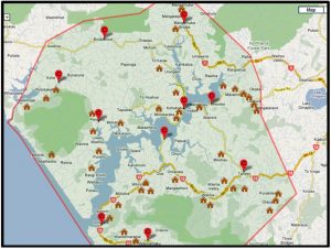
Map of marae and clinics in North and South Hokianga
